

Mount Yuidake (油井岳) rises to the north of Koniya (古仁屋) in Setouchi Town (瀬戸内町, Setouchi-cho), in the south of Amami Oshima.
From the observatory at the top, you look down on the Oshima Strait, the channel between Amami Oshima and Kakeroma Island (加計呂麻島), and on the outlines of the many islands and inlets. This view is counted as one of the “Amami Ten Views” (奄美十景, Amami Jikkei).
You can drive up to the observatory. This guide introduces the views in two directions from the top, the memories that remain in the forest and on the mountain, and what to know when you visit.

A mountain north of Koniya, in the middle of the Oshima Strait
Yuidake is a mountain on the Amami Oshima side of the middle of the Oshima Strait. It is about 480 m high (481.5 m in the elevation data of the Geospatial Information Authority of Japan). At its foot, along the strait, is the village of Yui (油井), which shares its name with the mountain.
A road runs up to the top. In the plan for Amami Gunto National Park (奄美群島国立公園) by the Ministry of the Environment, the road from around Jizo Pass (地蔵峠) on the national highway to Yuidake and Mount Kochiyama (高知山) is designated as the “Yuidake–Kochiyama Route,” a route to the main viewpoints over the Oshima Strait. It takes about 20 minutes by car from Koniya.
The same plan states that the Yuidake Observatory and the Kochiyama Observatory are both maintained and managed by Setouchi Town as places to look out over the Oshima Strait and Kakeroma Island.
The view of the Oshima Strait at the end of the walking path
Facing southwest from the observatory, the Oshima Strait spreads out below you.
The Oshima Strait is a long, narrow stretch of sea between Amami Oshima and Kakeroma Island. Its coastline is intricate, and capes, inlets and small islands overlap one another. The Ministry of the Environment’s Amami Oshima World Heritage Center also introduces the view of the Oshima Strait from the Yuidake Observatory as one chosen for the Amami Ten Views.
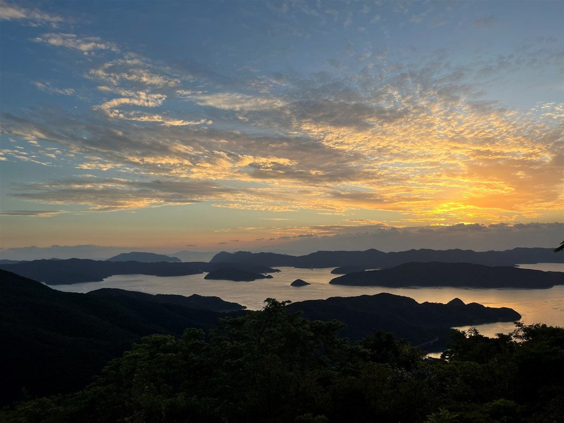
In the evening, the sun sets behind the ridgelines of the islands across the strait. On a clear day, the islands and the water turn the color of the sunset.
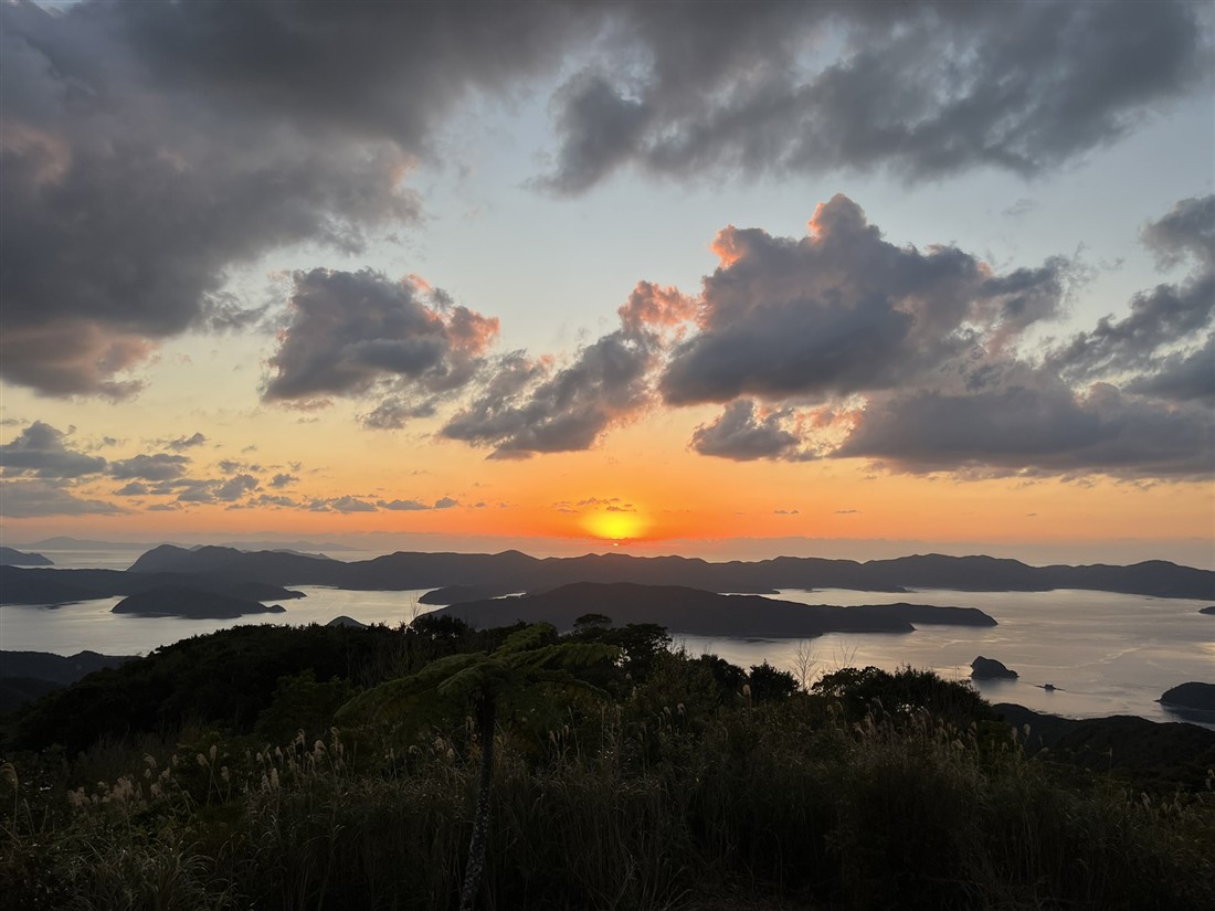
Even after sunset, while the sky is still bright, the shapes of the islands in the strait stand out clearly.
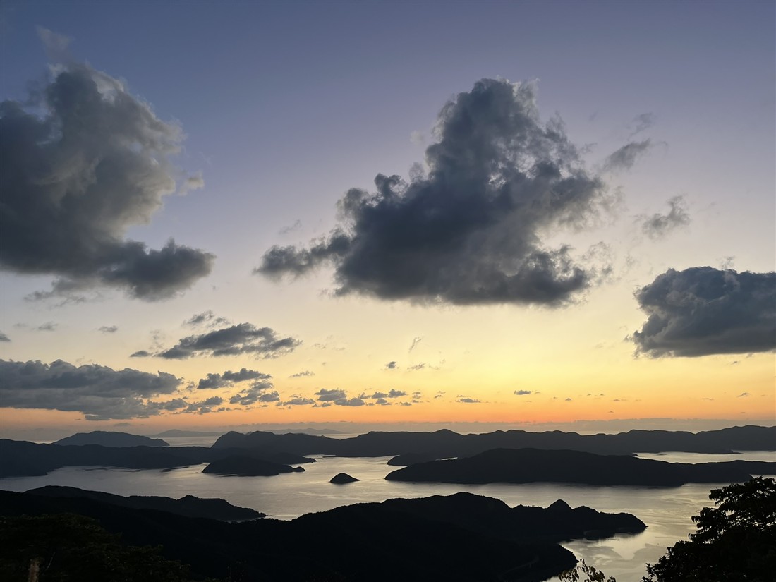
Visitor information says the view of the Oshima Strait is not from the observation deck right by the parking lot, but from the end of a walking path and steps that lead on from there. When you get out of the car, walk on to the end of the path.
By the parking lot: the view toward Isu Bay
From the observation deck right by the parking lot, you look in a different direction from the Oshima Strait: southeast, toward the village of Agina (阿木名) and Isu Bay (伊須湾). This is the direction of the sunrise.
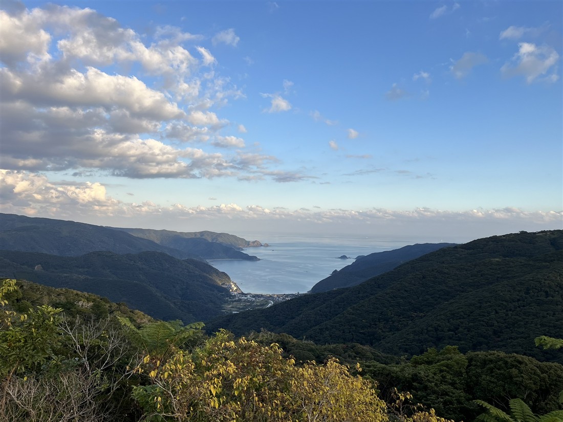
A bay opens at the end of a valley between the mountains, and the open sea continues beyond it. What makes Yuidake special is that from one mountaintop you can see both the sea inside the strait and a bay opening onto the open ocean.
The evergreen broadleaf forest covering the mountain
The observatory is surrounded by deep forest.
The Ministry of the Environment’s management plan for the national park notes that in the mountains of southern Amami Oshima, including the area around Yuidake, relatively old evergreen broadleaf forest, 60 to 80 years old or more, remains in large stretches, and is home to rare plants and animals found only here, such as the Amami rabbit (アマミノクロウサギ) and the Ryukyu long-haired rat (ケナガネズミ).
There are also habu (ハブ), a venomous snake, in the forest. Please stay on the walking paths around the observatory and do not go into the forest.
Memories of prayer and war on the mountain
Yuidake is not only a mountain for views. It has long been tied to the lives of the people living at its foot.
In the villages of Amami, mountains regarded as sacred are called Kamiyama (神山, “god mountains”), and the higher ones among them have been called “Obotsuyama” (オボツヤマ). In a 2005 survey report on archaeological sites in Setouchi Town, the folklorist Kenjiro Machi (町健次郎) notes that Yuidake is said to have had sacred places called obotsu on the mountain, in three levels: upper, middle and lower.
At the same time, Yuidake also holds memories of the Pacific War.
According to the town’s 2017 survey report on modern-era sites, the Amami Oshima Army Hospital in Koniya was moved to between Mount Kochiyama and Yuidake after its buildings were burned in an air raid around March 1945.
At a symposium on modern-era sites held by the town in 2023, Shosaku Hattori (服部正策), who has studied the wildlife of Amami for many years, spoke about the small square holes found here and there along the ridges of Yuidake. He said that a man he met on Tokunoshima Island (徳之島) had told him that, before the end of the war, he had been mobilized to Amami Oshima and had dug holes on Yuidake day after day, and that they were holes for hiding from American soldiers who were expected to land.
Most of these traces are in the forest and are not places you can visit without a guide. The forest you see from the observatory carries this history too.
When you visit
- If you go for the sunset, bring a light for the way back: once the sun goes down, the mountain road gets dark quickly. A flashlight will help.
- Wear comfortable shoes: to reach the spot with the view of the Oshima Strait, you walk along a path and steps through the forest.
- Combine it with the Kochiyama Observatory: you can also reach the Kochiyama Observatory from a fork in the road on the way to Yuidake. From the fork to Yuidake is about 5 minutes by car. From the Kochiyama Observatory, the town of Koniya and Kakeroma Island look close.
Basic information
| Yuidake Observatory | |
|---|---|
| Location | Near the summit of Yuidake, Setouchi Town, Oshima District, Kagoshima (鹿児島県大島郡瀬戸内町 油井岳の山頂付近) |
| From Koniya | About 20 min by car |
| Parking | Yes (free) |
| Toilets | None, according to visitor information (please check before you go) |
| Admission | Free |
| Inquiries | Setouchi Town Fisheries and Tourism Division (瀬戸内町 水産観光課) 0997-72-1115 |
Phone numbers are shown in the format used within Japan. When calling from outside Japan, dial +81 and drop the first 0.
The inner and outer seas, from the top of a mountain
The Oshima Strait, with its intricate capes and inlets and overlapping islands. From a mountaintop in the middle of it, Yuidake looks out over both the sea inside the strait and a bay opening onto the open ocean.
In the forest around the observatory you can drive up to, the prayers of the villages below and the memories of wartime overlap.
Also in Setouchi Town: two beaches on the inner and outer sides of the strait.
Yadori Beach and Honohoshi Coast: White Sand and Round Stones in Southern Amami Oshima
To reach Kakeroma Island across the strait, take the Ferry Kakeroma from Koniya:
Ferry Kakeroma Timetable and Fares | Koniya ⇔ Kakeroma Island (Seso / Ikenma)
How to get to Koniya by bus:
How to Get to Koniya Port | Bus Timetables from Naze and Amami Airport


Comments